
The Environment Agency has issued a flood alert warning in Cornish coastal areas for Tuesday (February 21) and Wednesday (February 22).
They've issued 'be prepared' warnings for coastal areas on the North Cornwall and South Cornwall coast during high tide in the morning.
In the flood alert for the North Cornwall and South Cornwall coasts, the Environment Agency says that flooding is possible during the high tides with the time of high water varying from the coast.
This is set to be accompanied by strong force five winds on the North Cornwall Coast and force six winds on the South coast.

.png?width=209&height=140&crop=209:145,smart&quality=75)
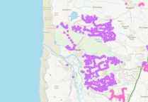

Five areas of the coast are impacted by the warning; the North Cornwall coast from Chapel Porth to The Rumps, excluding the tidal River Camel, the North Cornwall Coast from The Rumps to Hartland Point excluding Bude, the North Cornwall coast from Lands End to Chapel Point and the South Cornwall Coast at Lizard Point to Gribbin Head excluding Truro city and South Cornwall coast from Lands End to Lizard Point.
North Cornwall Coast from Chapel Porth to The Rumps excluding the Tidal River Camel
Flooding is possible over the high tide on Tuesday and Wednesday mornings. High water at Padstow is at 06:00 AM on Tuesday 21st February and at 06:42 AM on Wednesday 21st February, times of high water will vary along the coast. Strong force 5 winds from the south veering to the northwest and offshore wave heights of up to 2m are forecast to cause wave overtopping of sea defences and sea spray in exposed coastal locations. People are advised to stay away from risk areas and take care next to the coast. Keep up to date with weather and tide conditions on local radio. We will continue to monitor the situation and issue updates as required. Detailed tidal information for those who use it; The forecast high tide level at Padstow on Tuesday morning is 4.20 mAOD, which is 0.03 metres below astronomical tide level, and on Wednesday morning is 4.27 mAOD, this is 0.07 metres below astronomical tide level.
Flood alert area: Chapel Porth to The Rumps including Trevellas, Perranporth, Newquay, Mawgan Porth, Porth and Polzeath, excluding the tidal River Camel
North Cornwall Coast from The Rumps to Hartland Point excluding Bude
Flooding is possible over the high tide on Tuesday and Wednesday morning. High water at Padstow is at 06:00 AM on Tuesday 21st February and at 06:42 AM on Wednesday 22nd February, times of high water will vary along the coast. Strong force 5 winds from the south, veering to the north-west, and wave heights of up to 2m are forecast to cause wave overtopping of sea defences and sea spray in exposed coastal locations. People are advised to stay away from risk areas and take care next to the coast. Keep up to date with weather and tide conditions on local radio. We will continue to monitor the situation and issue updates as required. Detailed tidal information for those who use it; The forecast high tide level at Padstow on Tuesday morning is 4.20 mAOD, this is 0.03 metres below astronomical tide level, and on Wednesday morning is 4.27 mAOD, this is 0.07 metres below astronomical tide level.
Flood alert area: The Rumps to Hartland Point including Port Quinn, Port Isaac, Port Gaverne, Flexbury, Widmouth Bay, Trebarwith Strand and Boscastle.
South Cornwall Coast from Lizard Point to Gribbin Head excluding Truro City
Flooding is possible over the high tide on the morning of Wednesday 22nd February. High water at Truro is at 06:52am, times of high water will vary along the coast. Winds of up to Force 6 from the Northwest with wave heights over 2 metres are forecast. Locations particularly at risk include low lying areas along the tidal rivers Helford and Fal, including the A39 at Perranarworthal, and exposed coastal locations including Portmellon seafront, Mevagissey Harbour area, and Portholland. Expect tides to be around 100mm higher than predicted due to weather conditions. People are advised to stay away from risk areas and take care next to the coast. Keep up to date with weather and tide conditions on local radio. We will continue to monitor the situation and issue updates as required. Detailed tidal information for those who use it; The forecast high tide level at Newlyn is 3.05 mAOD, this is 0.09 metres above astronomical tide level.
Flood alert area: Lizard Point to Gribbin Head including the tidal rivers Helford and Fal, Penryn, Flushing, St Mawes, Portscatho, Portloe, Portholland, Mevagissey and Par
Comments
This article has no comments yet. Be the first to leave a comment.